Training Course on Application of GIS in Monitoring and Evaluation
About the Course
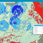
The integration of GIS in monitoring and Evaluation makes it possible to link, or integrate information that is difficult to associate through any other means. Presenting data in the form of a map helps to understand the significance of “where”. The use of GIS in monitoring and Evaluation improves the effectiveness and communications of results to management, funding partners, and beneficiaries. This training is aimed at helping development partners to monitor and evaluate the activities of specific projects intended to support M&E systems for sustainable programs and projects.
Target Participants
This training is designed for professionals in projects/programs who want to apply GIS to improve their monitoring and evaluation systems.
What you will learn
By the end of the course the learner should be able to:
- Understand key concepts in M&E and GIS
- Discuss new technologies being adopted in project monitoring and evaluation
- Learn about the working of M&E information management systems
- Learn how to collect data using mobile phones and GPS
- Learn how to integrate existing M&E data with GIS
- Learn how to analyze and visualize M&E data with the aid of GIS techniques
- Learn how to integrate GIS into M&E activities
Course duration
5 days
Course Outline
Overview of Key M&E concepts
- Introduction to M&E
- Key components of M&E
- Challenges facing M&E Designing an M&E system
- Results chain and impact pathways
- M&E frame works
- Theory of change
Communicating M&E results
- Developing a GIS integrated communication system
- Why is communication important in GIS?
- Presentation of findings/results
New technologies being adopted in project M&E
- GIS
- Mobile phones in M&E
- Participatory videos for M&E
- Supporting bottom-up learning
- Making real-time M&E a reality through ICT
- Examples of M&E systems incorporating GIS
Introduction to concepts of GIS and remote sensing
- GIS software
- GIS system installation and setup
- GIS Data sources and types
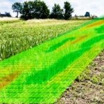
Spatial data collection techniques for project management
- Using GPS
- Using GPS utility software for managing and downloading and managing data
- Working with data from different sources
- Attributes manipulation in GIS
- Using Mobile Phones for GIS data collection
- Importing GPS data to Quantum GIS
Visualizing project data
- Understand map layers in GIS
- Composing a GIS layout from GIS layers
- Difference between a map and a layout
- Navigate maps
- Bringing tabular/spreadsheet data into a GIS (Excel, SPSS, Access etc)
- Connecting visual map features and tabular data
- Selecting subsets of map features from geo processing
- Finding map features
- Use data sorting records and labeling features to produce information
- Key elements of a map
- Composing a map
- Case study
GIS and GPS for M&E
- General principles of monitoring and evaluation systems
- Integrating M&E and geographic information systems (GIS)
- Deciding if M&E -GIS is appropriate for specific projects
- Developing an M&E -GIS system for projects
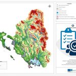
- Creating maps supporting monitoring and evaluation systems
- Selecting GIS software
- Defining the data requirements and key indicators
- Defining the data collection process
- Designing and creating the data input table
- Map making
- Creating the thematic map
Updating data in the M&E-GIS system
- Getting periodic reports from the field
Preparing monitoring and evaluation reports /communicating results
- Preparing the working project reporting maps
- Case study
Training Approach
This course is delivered by our seasoned trainers who have vast experience as expert professionals in the respective fields of practice. The course is taught through a mix of practical activities, theory, group works and case studies.
Training manuals and additional reference materials are provided to the participants.
Certification
Upon successful completion of this course, participants will be issued with a certificate.
Tailor-Made Course
We can also do this as a tailor-made course to meet organization-wide needs. Contact us to find out more info@trainingsinkigali.com
Payment
The training fee covers tuition fees, learning materials, and training venue. Accommodation and airport transfer are arranged for our participants upon request.
Payment should be sent to our bank account before start of training and proof of payment sent to info@trainingsinkigali.com
Online trainings
Do you wish to partake this course through an online platform? KICDDA team of expert trainers are standby to support you in learning this course at your preferred pace and schedule. Our instructor-led online courses can also be tailored to accommodate participants specific needs. Request to take this course online by sending your request through:
Email: info@trainingsinkigali.com
Phone: +250 784 481 618 or +250 786 156 256
Other courses that you may like…