Below is a list of events under GIS and Remote Sensing which are open for registration at this time. You can view more information about this event by clicking on a specific event.

Training Course on GIS Mapping and Spatial Data Analysis
Giving a spatial dimension to data and performing spatial analysis speeds up implementation of projects and programmes. Learn how to apply GIS and remote sensing technology and get the best out of spatial data using ArcGIS software.
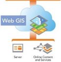
Training Course on Web-based GIS and Mapping
Open-source software such as QGIS, PostGIS, GeoServer, and OpenLayers are known to deliver complete GIS solutions. Learn how to create browser-based map applications, load, publish, and share geospatial data, as well as create spatial databases with querying capabilities.

Training Course on Application of GIS in Monitoring and Evaluation
GIS makes it possible to link, or integrate information that is difficult to associate through any other means. GIS improves the effectiveness and communications of project results. Learn how to monitor and evaluate project activities through GIS.

Training Course on Application of GIS in Agriculture and Climate Change
GIS and remote sensing technologies can help enhance the implementation of projects. Enroll for this training workshop and benefit with handy skills on how to integrate spatial analysis techniques with knowledge about climate change, agriculture, and food security.

Training Course on Application of GIS in Health
Health sector continues being complex and multi-faceted, warranting good research. This course aims at equipping the learners with knowledge to use GIS tools to visualize indicators in health, explore spatial data and analyze maps to communicate information and make decisions.

Training Course on Application of GIS in Water, Sanitation and Hygiene
The overall goal of projects and programs (as well as the associated monitoring and evaluation efforts) can fail when GIS is not incorporated. This training workshop will equip participants with skills on how to apply GIS technology in Water, Sanitation and Hygiene (WASH) projects and programmes.
Group Trainings on GIS and Remote Sensing
Do you wish to partake any of our trainings as a group? Send us your request by clicking on the link below: